
Sentinel Hub EO Browser
A complete archive of Sentinel-1, Sentinel-2, Sentinel-3, Sentinel-5P, ESA’s archive of Landsat 5, 7 and 8, global coverage of Landsat 8, Envisat Meris, MODIS, Proba-V and GIBS products in one place. EO Browser makes it possible to browse and compare full resolution images from all available data collections provided.

Copernicus Open Access Hub
The Copernicus Open Access Hub (previously known as Sentinels Scientific Data Hub) provides complete, free and open access to Sentinel-1, Sentinel-2, Sentinel-3 and Sentinel-5P user products.
CSRS-Precise Point Positioning (PPP)
An online application of the Canadian Geodetic Survey of Natural Resources Canada for GNSS data post-processing allowing users to compute higher accuracy positions from their raw observation data.

AUC GEOGRAPHICA
AUC Geographica (Acta Universitatis Carolinae Geographica) is a scholarly academic journal continuously published since 1966 that publishes research in the broadly defined field of geography. There are no author fees or charges required for manuscript processing and/or publishing.
Geo-harmonizer
EU-wide automated mapping system for harmonization of Open Data based on FOSS4G and Machine Learning. The overall objective of the Action is to develop an original, web-based, scalable and modular system ("Geo-harmonizer") for hosting and accessing various thematic geospatial data layers (vector and raster GIS layers) to support cross-border services over the entire continental Europe.
Sentinel Application Platform (SNAP)
Earth Observation processing and analysis software from the European Space Agency (ESA)
QGIS
A free and open-source cross-platform desktop geographic information system (GIS) application that supports viewing, editing, and analysis of geospatial data
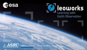
LEOWorks
Image Processing/Geographic Information System (GIS) for Educational Purposes from the European Space Agency (ESA)

Pyrocko
Pyrocko is an open source seismology toolbox and library, written in the Python programming language. It can be utilized flexibly for a variety of geophysical tasks, like seismological data processing and analysis, modelling of InSAR, GPS data and dynamic waveforms, or for seismic source characterization.